This dam has an unusually large spread of conflicting numbers across sources. Even government documents disagree with each other. Where that happens, this page lists every figure found rather than silently picking one.
Quick specs
| Type | Composite masonry gravity dam: rubble masonry faces, lime-surkhi concrete core (no cement, no steel) |
| Height | 53.66 m / 176 ft above deepest foundation; ~155 ft measured from the riverbed |
| Length | 365.7 m / 1,200 ft (main dam); a separate 240 ft "baby dam" connects to an earthen embankment on the left bank |
| Crest width | 3.6 m / 12 ft originally; ~21 ft including the 1980s parapet/cap |
| Base width | 42.2 m / 138 ft |
| Spillway | 13 chute vents on the right saddle (10 original + 3 added); vent height disputed, 16 ft vs. 10 ft across sources; combined discharge capacity ~3,455 m³/s |
| Probable Maximum Flood | 8,676 cumecs, only ~2.6% above the largest flood actually recorded at the site (8,453 cumecs, 1943), a thin margin worth noting |
| Baby dam (left bank) | 240 ft long; height disputed, 53 ft vs. 47 ft across sources |
| Catchment area | 624 km² (a 1,206 km² figure also circulates but is less corroborated) |
| Reservoir surface area | 26 km² (10 sq mi) |
| Coordinates | 9°31′43″N 77°8′39″E, elevation 881 m, inside the Periyar Tiger Reserve |
Dam type & materials
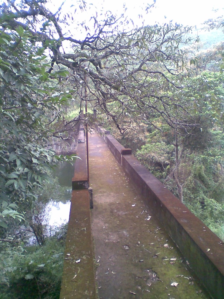
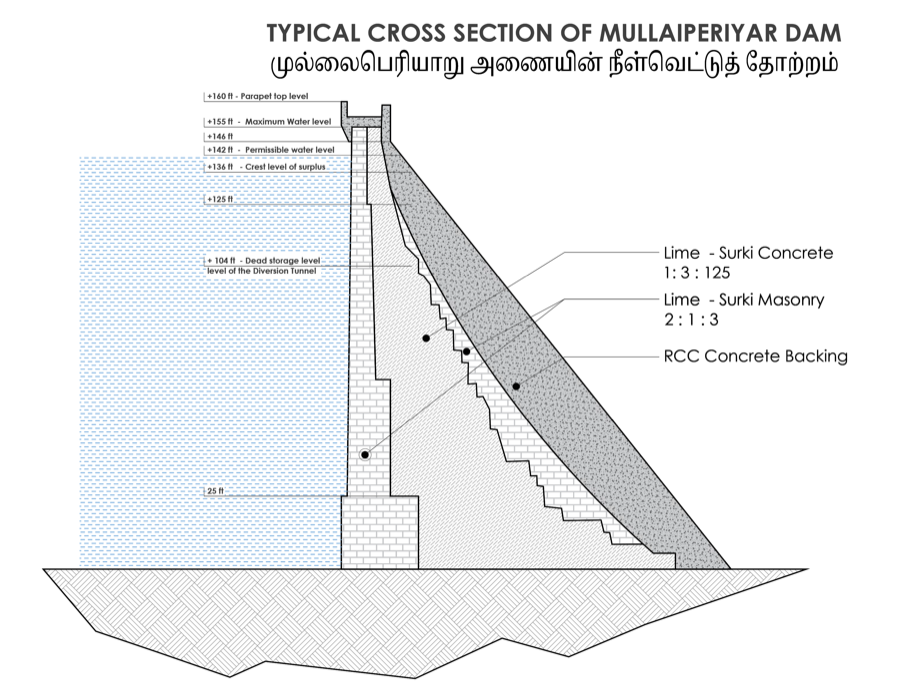
Mullaperiyar is best described as a composite gravity structure: uncoursed rubble masonry set in lime-surkhi-sand mortar for the upstream and downstream faces, with a core, roughly 60–62% of the dam's total volume, made of lime-surkhi concrete rather than cement concrete, which simply wasn't practically available for a project this remote in the 1880s. In the 1980s, a 10-metre concrete backing was added to the downstream face along with an RCC cap at the crest, but the joint between the 1895 masonry and the 1980s concrete was never grouted. Engineers relied on shear keys instead to transfer load across it, a detail that keeps coming up in the safety debate (see Safety).
The 136 / 142 / 152 ft story
These three numbers are the crux of the entire modern dispute, and they're often thrown around without explanation:
The dam was designed to hold 152 feet. That fell to 150 feet by 1964, then, after a 1979 CWC inspection found leaks and structural weakness, was cut sharply to 136 feet, where it stayed, contested, for over three decades. A further CWC-chaired meeting in April 1980 opined that once emergency strengthening was complete, 145 feet would be feasible, though that intermediate step was never actually implemented. A Supreme Court-appointed Expert Committee found 142 feet safe in 2001. The Court authorized it in 2006. Kerala legislated around that ruling. The Court struck that law down in 2014 and made 142 feet the enforceable ceiling. The reservoir first actually reached 142 feet in November 2014, the first time in 35 years. Tamil Nadu's 2026 government is now pushing to go the rest of the way to 152 feet. Full legal history: The Dispute.
| FRL | Gross storage | Live storage |
|---|---|---|
| 136 ft | 11.21 TMC | 6.12 TMC |
| 142 ft | 12.76 TMC | not published |
| 152 ft | 15.66 TMC | 10.57 TMC |
The diversion tunnel
From the reservoir, water travels through a deep open cutting roughly a mile long, then a 5,704-foot (1.74 km) tunnel bored directly through the Western Ghats watershed, the dam's real engineering signature. It's a rare inter-basin transfer: water moves from the Arabian Sea drainage basin into the Bay of Bengal basin, entirely by gravity, with design capacity around 2,000 cusecs. On the far side it discharges into the Suruliyar, a tributary of the Vaigai. A more granular breakdown in some sources splits this into a 5,342 ft open cutting plus a 5,887 ft tunnel proper (12 ft high, 150 sq ft cross-section, 2,100-cusec capacity); the two figures don't reconcile cleanly and likely measure different segments of the same route. One figure that does not check out: a "7.2 km" tunnel length that circulates in a handful of sources is almost certainly a conversion error, since 5,704 ft is only about 1.74 km.
Irrigation system
Water reaches the Peranai regulator and feeds the Periyar Main Canal (58 km, 40 m³/s capacity, 57,900 ha command) and, after the 1958 Vaigai Dam was built partly to re-regulate the power station's tailrace, the Thirumangalam Main Canal (27 km, 5,300 ha). Together they serve Theni, Madurai, Dindigul, Sivaganga and Ramanathapuram districts. Paddy is the dominant crop, often double-cropped; the Cumbum Valley specifically produces roughly 85% of Tamil Nadu's grapes off this water.
The command area has grown considerably since commissioning: from roughly 63,200 ha under the two main canals as of 1976/77, to a commonly-cited 229,718 acres by 1994–95. One figure that doesn't hold up under scrutiny is a claim of 685,000 hectares (1.7 million acres) found in a single tourism-oriented source. It's 5–10× larger than every other figure located and is treated here as an outlier, likely conflating the command area with total district agricultural land.
Hydropower: a common point of confusion
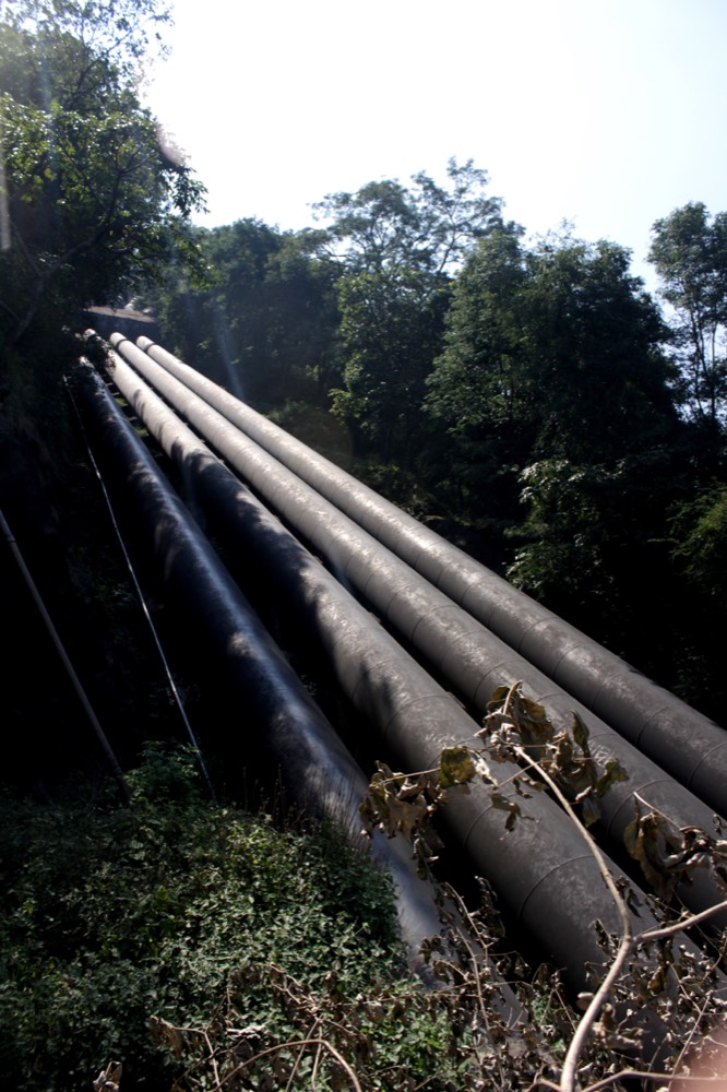
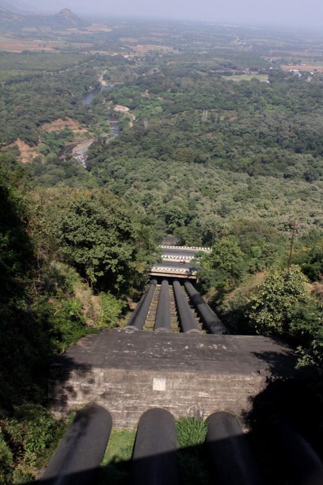
Two separate hydro projects exist on the Periyar system, and they're frequently mixed up. The Periyar Power Station (Lower Camp, Theni District, Tamil Nadu, TNEB/TANGEDCO, originally 140 MW, being uprated toward 168 MW) is fed by Mullaperiyar's diverted water. The unrelated "Lower Periyar" project (Neriamangalam, Kerala, KSEB, 180 MW) draws on the Periyar's own natural downstream course inside Kerala and has nothing to do with the Mullaperiyar diversion, despite the near-identical name.
Power revenue is split under the same 1970 lease renewal that governs land use: Tamil Nadu pays Kerala roughly Rs 2.5 lakh/year in land tax plus a Rs 7.5 lakh/year surcharge tied to power generated, alongside a per-unit charge cited at around Rs 12/kWh for electricity generated at Lower Camp using Mullaperiyar's water. That 1970 arrangement technically expired in 2000, and the terms for anything generated since remain part of the wider unresolved dispute.
Who runs it
Land ownership stays with Kerala. The 1886 agreement was always a lease, never a sale. Construction, operation and maintenance rest with Tamil Nadu, via its Water Resources Department, under that lease and its 1970 supplement. Since 2014, oversight runs through a Supreme Court-mandated Supervisory Committee with a CWC chair and one member from each state, based at Kumily. Full legal mechanics: who actually owns Mullaperiyar.
Documented monitoring equipment includes seismographs and accelerographs (the dam sits close enough to felt seismicity that a magnitude-4.5 earthquake struck within 20 km in June 1988), rain gauges, and seepage-measurement weirs, with routine physical inspection by Tamil Nadu Water Resources Department engineers. See Safety for how complete, or incomplete, this instrumentation has actually been found to be.
Age in context
Completed in 1895, the dam predates the oldest concrete gravity dams still standing anywhere in the world by a small margin. Lime-surkhi masonry, done well, can in principle outlast concrete, since it degrades by different mechanisms. But no international engineering body publishes a standardized "design life" for masonry gravity dams the way one exists for concrete (typically 50–100 years). That cuts both ways: it undercuts the simple "it's old, therefore unsafe" argument, but it equally means the dam can't point to any engineering standard certifying its longevity. Only continuous condition monitoring can do that. Full safety analysis: Safety Debate.
Global comparison
Mullaperiyar's tunnel predates the next comparable engineering-era tunnel diversion, the USA's Gunnison Tunnel (1905–09), by about a decade, and predates the entire 20th-century wave of transbasin megaprojects (California's aqueducts, Australia's Snowy Mountains Scheme, China's South–North Water Transfer) by 40 years or more. Unlike almost all of them, it moves water with zero pumping, pure gravity. Contemporary accounts called it "one of the most extraordinary feats of engineering ever performed by man." And yet, unlike the Gunnison Tunnel (a US National Historic Civil Engineering Landmark) or the Snowy Scheme (on Australia's National Heritage List), no international engineering-heritage body appears to have ever recognized Mullaperiyar. That's an absence of evidence rather than a settled fact (heritage bodies simply haven't surveyed much 19th-century colonial-India infrastructure the way they have British, American and Australian projects), but either way, its global reputation today is built almost entirely around the safety dispute, not the engineering achievement.
The closest institutional sibling isn't abroad at all. Barely 100 km away, across the same Western Ghats range, the Parambikulam-Aliyar Project reproduces nearly the identical arrangement: Kerala owns the Parambikulam Dam, Tamil Nadu operates and maintains it, under its own interstate agreement (also revised in 1970). It has its own recurring shortfall disputes, including a period after February 2004 when Kerala reportedly received no water at all. It shows the Mullaperiyar model wasn't a one-off colonial anomaly but something closer to a template for how the two states share Western Ghats water.
| Project | Built | Method |
|---|---|---|
| Mullaperiyar (India) | 1887–1895 | Gravity tunnel, 1.74 km, zero pumping |
| Parambikulam-Aliyar (India) | Mid-20th century | Interlinked dams/canals; same Kerala-owns/TN-operates structure |
| Gunnison Tunnel (USA) | 1905–1909 | Bored tunnel, 9.3 km |
| Snowy Mountains Scheme (Australia) | 1949–1974 | 225 km of tunnels/aqueducts, 2 pumping stations |
| California State Water Project (USA) | 1960–1973 | 700+ mi canals; highest single water lift in the world |
| South–North Water Transfer (China) | 2003–present | Canals + pumping; 44.8 km³/yr planned capacity |
Sources
- Wikipedia: Mullaperiyar Dam; Vaigai Dam; Gunnison Tunnel; Snowy Mountains Scheme
- Government of India, Jal Shakti / Dept. of Water Resources: "Mulla Periyar Dam Issue" briefing note
- World Bank Report No. 1519a-IN (1977): "India: Periyar Vaigai Irrigation Project"
- expert-eyes.org: technical dam-specification detail (independent, advocacy-oriented; figures cross-checked where possible)
- power-technology.com: Periyar and Lower Periyar power plant profiles